Street View Page on
Costa Rica
Google
Street View is available through Google Maps and Google Earth and provides
panoramic views along many streets in the world. It was started in 2007 in the
United States and has since expanded to include a large number of countries.
Some countries have objected to this form of data gathering and have not
allowed Google to take the imagery, Germany being the main hold-out. Available
Street View imagery available is shown as blue lines on Google Maps once the
so-called pegman has been activated. Images are most
often taken by car but a variety of other modes of transport have been used.
Once captured, the images are subsequently stitched together. In some areas,
Street View images are augmented by privately-done photospheres.
Outline
- Street View screen captures
- First StreetView of the Irazu
Volcano
- Second StreetView of Tamarindo Bay
- Third StreetView of the trail up to the Monteverde Cloud
Forest
- Links to Street View panoramas
- Link to first panorama of
the Irazu Volcao
- Link to second panorama
of Tamarindo Beach
- Link to third panorama of
the Monteverde Cloud Forest
- MapChannels Street View Animation
- Route from Cala Luna
Vacation Villas to Tamarindo Beach
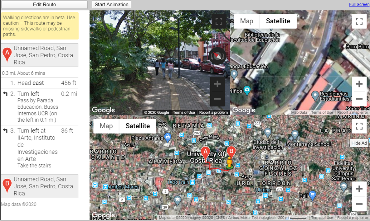
- Route from The University
of Costa Rica School of Mathematics, to the Fine Arts Theatre
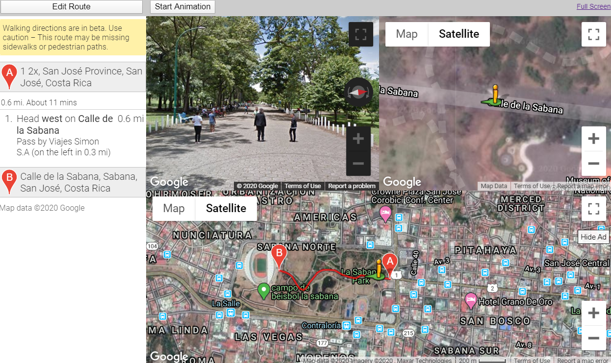
- Route from La Sabana Park to the National Stadium
- Moore's Where to Invade Next
- The value of travel
1 Street View
Screen Captures
Insert three screen captures here with descriptions. By screen capture, I mean the procedure we used with the airfare assignment. Don't capture your whole screen, only the Street View image.
Example: Irazu Volcano
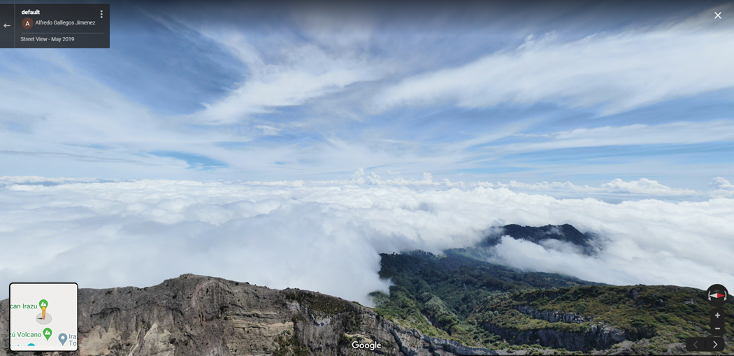
This picture of the Irazu Volcano was captured in May 2019. This is a view away from Irazu at 3,200 meters.
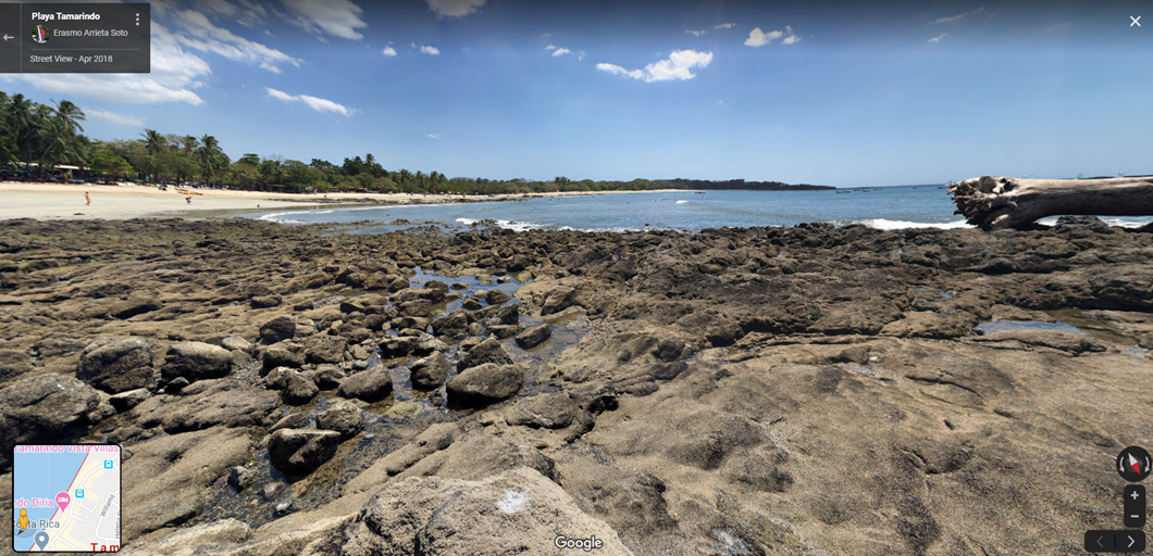
A view of Tamarindo Bay in April 2018. This area is known as the best surfing area in Costa Rica.
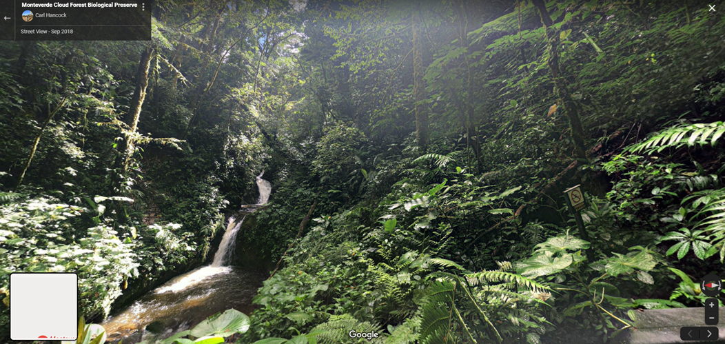
This trail is at about 1,200ft, leading up into the cloud forest.
2 Links to Street
View Panoramas
Insert three links with descriptions to Street View Panoramas here. In contrast to above, these are "live links" so you'll be able to spin the image once they appear.
Example-1: Tamarindo Beach, Guanacaste Province
Example-2: Irazu Volcano, Cartago Province
Example-3: Monteverde Cloud Forest
3 MapChannels Streetview Player
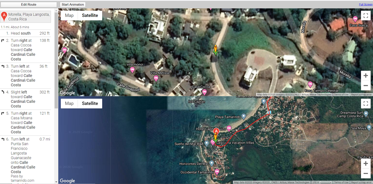
My
first animation. This is an aimation of a walk from Cala Luna Hotel to
Taramindo beach. This area of Costa Rica does not offer a street view..
University of Costa Rica. Animation of walking from the to the Schools of Mathematics to the Fine Arts Theatre at the University of Costa Rica, San Jose. This animation takes you on a walk through the university’s campus. It is done in such a way where you should get a little taste of what it would be like walking around on campus yourself. In the animation you can see some of the university architecture, the greenery, and some of the students walking to class.
La Sabana Park. La Sabana Park is the largest park in the city of San Jose. This animation takes you on a walk through the park to Costa Rica’s National Futbol Stadium.
4 Moore's Where
to Invade Next
Smarter-than-thou movies didn’t start with Michael Moore and the partisanship he popularized with Fahrenheit 911, but they are a symptom of millennial elitism. Smarter-than-thou movies can be traced to indie filmmakers working outside the major studios’ commercial concern for broad appeal; instead, they sought a specialty market that prided itself on its “sophistication” based on class and cultural bias as much as on political leanings” (White). Armon White’s review as can be seen from the above quote, is heated and emotional. White uses the term millennial elitism to generalize a generation of movie goers and filmmakers who are trying to do something different—his anger seems misguided. Moore’s documentary is meant to be bring a person to ask questions about their own countries’ values, which as someone who’s traveled, I know traveling does. I don’t agree with every thought Moore has, but I did feel that the film was well made, because the dichotomies of political position that were presented in the film made you feel like you were traveling and confronted with these positions yourself. There are many reasons why America is the best country in the world, but that wasn’t the point of this film. The point of this film was to point out where America could improve and where America has taken some ideas from and improved upon them.
Submitted
by Tim Callahan on April 17th.